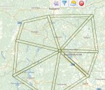
Не смог из фплн скинуть план в московский зональный хотя ссылка есть (она правда и в старой версии фплн у меня не работала), выскочила страничка с какой то големотьей для меня не понятной.
Толком не работает пока еще. Про голематью - читайте ТС-2013(табель сообщений о движении ВС)
http://www.consultant.ru/document/cons_doc_LAW_147062/?frame=1
Кстати Вы не подскажете в каком разделе ТС 2013 посмотреть что значит нижеизложенная информация:
snode encountered an error when processing the request.
HRESULT: 0x6d
HTTP status: 500
HTTP reason: Internal Server Error
You are receiving this HTTP 200 response because system.webServer/iisnode/@devErrorsEnabled configuration setting is 'true'.
In addition to the log of stdout and stderr of the node.exe process, consider using debugging and ETW traces to further diagnose the problem.
The last 64k of the output generated by the node.exe process to stderr is shown below:
[x1B][31merror[x1B][39m: [[x1B][90mservices\elevation.js[x1B][39m] elevation:crossing intersection=[enter=true, distance=10, position=[54.499775534643526, 37.69833221884711], distance=168.773, enter=false, position=[54.499787306136234, 37.698289683509465], distance=168.7709, enter=false], _bsontype=ObjectID, id=UR¾'ÒÒ[x02]d[x12]O5£, type=CTRZ, min=8077.2, max=16154.4, str=FL265 - FL530, id=A28562, description=Класс ВП: А
FL265 - FL530
Расписание: H24
, path=[0=57.0333, 1=38, 0=57.1, 1=37.7167, 0=56.27, 1=35.8133, 0=56.1617, 1=35.29, 0=55.8333, 1=34.8667, 0=55.55, 1=35.0333, 0=54.7333, 1=36.65, 0=54.6, 1=37.3333, 0=54.35, 1=38.2333, 0=54.2333, 1=38.9, 0=55.55, 1=40, 0=56.0333, 1=39.6333, 0=57.0333, 1=38], active=true
[x1B][31merror[x1B][39m: [[x1B][90mservices\elevation.js[x1B][39m] elevation:crossing intersection=[enter=true, distance=10, position=[54.499775534643526, 37.69833221884711], distance=168.773, enter=false, position=[54.499787306136234, 37.698289683509465], distance=168.7709, enter=false], _bsontype=ObjectID, id=UR¾'ÒÒ[x02]d[x12]O5¤, type=CTRZ, min=1219.2, max=8077.2, str=FL40 - FL265, id=A28563, description=Класс ВП: С
FL40 - FL265
Расписание: H24
, path=[0=57.0333, 1=38, 0=57.1, 1=37.7167, 0=56.27, 1=35.8133, 0=56.1617, 1=35.29, 0=55.8333, 1=34.8667, 0=55.55, 1=35.0333, 0=54.7333, 1=36.65, 0=54.6, 1=37.3333, 0=54.35, 1=38.2333, 0=54.2333, 1=38.9, 0=55.55, 1=40, 0=56.0333, 1=39.6333, 0=57.0333, 1=38], active=true
[x1B][31merror[x1B][39m: [[x1B][90mservices\elevation.js[x1B][39m] elevation:crossing intersection=[enter=true, distance=10, position=[54.499775534643526, 37.69833221884711], distance=168.773, enter=false, position=[54.499787306136234, 37.698289683509465], distance=168.7709, enter=false], _bsontype=ObjectID, id=UR¾[x1C]ÒÒ[x02]d[x12]O1), type=RZ, min=1219.2, max=16154.4, str=FL40 - FL530, id=A28460, description=Класс ВП:
FL40 - FL530
Расписание: H24
, path=[0=57.0333, 1=38, 0=57.1, 1=37.7167, 0=56.27, 1=35.8133, 0=56.1617, 1=35.29, 0=55.8333, 1=34.8667, 0=55.55, 1=35.0333, 0=54.7333, 1=36.65, 0=54.6, 1=37.3333, 0=54.35, 1=38.2333, 0=54.2333, 1=38.9, 0=55.55, 1=40, 0=56.0333, 1=39.6333, 0=57.0333, 1=38], active=true
[x1B][31merror[x1B][39m: [[x1B][90mservices\elevation.js[x1B][39m] elevation:crossing intersection=[enter=true, distance=10, position=[55.779170991052105, 37.37499999999999], distance=2.383, enter=false, position=[55.689183182158544, 37.41875873093598], distance=12.754, enter=true, position=[55.683684778440714, 37.42142568659445], distance=13.394, enter=false, position=[55.66738255860282, 37.4330426352024], distance=15.391, enter=false, position=[55.57619178987056, 37.605983139198756], distance=30.244, enter=true, position=[55.21681290202071, 37.35361295032369], distance=82.683, enter=false], _bsontype=ObjectID, id=UR¾%ÒÒ[x02]d[x12]O3ü, type=CTRZ, min=0, max=300, str=GND - 300м AGL, id=A25321, description=Класс ВП: С
GND - 300Рј AGL
Расписание: H24
, path=[0=55.8333, 1=36.95, 0=55.8667, 1=36.9167, 0=55.77, 1=36.8667, 0=55.625, 1=36.875, 0=55.5644, 1=36.8953, 0=55.2333, 1=36.95, 0=55.2167, 1=37, 0=55.2167, 1=37.4317, 0=55.2167, 1=37.5167, 0=55.35, 1=37.5333, 0=55.5667, 1=37.6167, 0=55.575, 1=37.62, 0=55.5767, 1=37.6, 0=55.5933, 1=37.5233, 0=55.5967, 1=37.5117, 0=55.6033, 1=37.5033, 0=55.6133, 1=37.495, 0=55.66, 1=37.4383, 0=55.6833, 1=37.4217, 0=55.6933, 1=37.4167, 0=55.7083, 1=37.395, 0=55.7267, 1=37.3833, 0=55.745, 1=37.375, 0=55.78, 1=37.375, 0=55.79, 1=37.3783, 0=55.8033, 1=37.39, 0=55.8333, 1=37.3967, 0=55.8333, 1=36.95], active=true
[x1B][31merror[x1B][39m: [[x1B][90mservices\elevation.js[x1B][39m] elevation:crossing intersection=[enter=true, distance=10, position=[55.779170991052105, 37.37499999999999], distance=2.383, enter=false, position=[55.689183182158544, 37.41875873093598], distance=12.754, enter=true, position=[55.683684778440714, 37.42142568659445], distance=13.394, enter=false, position=[55.66738255860282, 37.4330426352024], distance=15.391, enter=false, position=[55.57619178987056, 37.605983139198756], distance=30.244, enter=true, position=[55.21681290202071, 37.35361295032369], distance=82.683, enter=false], _bsontype=ObjectID, id=UR¾ ÒÒ[x02]d[x12]O1“, type=MDPZ, min=0, max=450, str=GND - 450м MSL, id=A30235, description=Класс ВП: G
GND - 450Рј MSL
Расписание: H24
, path=[0=55.8667, 1=36.9167, 0=55.77, 1=36.8667, 0=55.625, 1=36.875, 0=55.5644, 1=36.8953, 0=55.2333, 1=36.95, 0=55.2167, 1=37, 0=55.2167, 1=37.4317, 0=55.2167, 1=37.5167, 0=55.35, 1=37.5333, 0=55.5667, 1=37.6167, 0=55.575, 1=37.62, 0=55.5767, 1=37.6, 0=55.5933, 1=37.5233, 0=55.5967, 1=37.5117, 0=55.6033, 1=37.5033, 0=55.6133, 1=37.495, 0=55.66, 1=37.4383, 0=55.6833, 1=37.4217, 0=55.6933, 1=37.4167, 0=55.7083, 1=37.395, 0=55.7267, 1=37.3833, 0=55.745, 1=37.375, 0=55.78, 1=37.375, 0=55.79, 1=37.3783, 0=55.8033, 1=37.39, 0=55.8333, 1=37.3967, 0=55.8333, 1=36.95, 0=55.8667, 1=36.9167], active=true
[x1B][31merror[x1B][39m: [[x1B][90mservices\elevation.js[x1B][39m] elevation:crossing intersection=[position=[55.505039822213604, 37.33498193576722], distance=49.694, enter=true, position=[55.43929874442294, 37.32558524509201], distance=57.868, enter=false, position=[55.43929873183242, 37.325584974460696], distance=57.8688, enter=false], _bsontype=ObjectID, id=UR¾$ÒÒ[x02]d[x12]O38, type=CTRZ, min=0, max=400, str=GND - 400м AGL, id=A22327, description=Класс ВП: С
GND - 400Рј AGL
Расписание: H24
, path=[0=55.525, 1=37.75, 0=55.5017, 1=37.2683, 0=55.4367, 1=37.27, 0=55.4583, 1=37.75, 0=55.525, 1=37.75], active=true
[x1B][31merror[x1B][39m: [[x1B][90mservices\elevation.js[x1B][39m] elevation:crossing intersection=[position=[55.77917099105214, 37.37499999999999], distance=2.383, enter=true, position=[55.69323609625615, 37.41679239995913], distance=12.294, enter=false, position=[55.68918318215353, 37.41875873093842], distance=12.754, enter=true, position=[55.667382558602704, 37.4330426352025], distance=15.391, enter=true, position=[55.57619178987055, 37.605983139198855], distance=30.244, enter=false], _bsontype=ObjectID, id=UR¾&ÒÒ[x02]d[x12]O5Z, type=CTRZ, min=0, max=450, str=GND - 450м MSL, id=A28567, description=Класс ВП: С
GND - 450Рј MSL
Расписание: H24
, path=[0=55.8933, 1=37.695, 0=55.8933, 1=37.675, 0=55.8967, 1=37.645, 0=55.9, 1=37.6217, 0=55.9083, 1=37.59, 0=55.91, 1=37.5783, 0=55.9083, 1=37.55, 0=55.9017, 1=37.5233, 0=55.885, 1=37.4867, 0=55.8817, 1=37.475, 0=55.8817, 1=37.4583, 0=55.8783, 1=37.4467, 0=55.87, 1=37.4183, 0=55.865, 1=37.4083, 0=55.85, 1=37.3983, 0=55.8417, 1=37.3967, 0=55.8333, 1=37.3967, 0=55.8033, 1=37.39, 0=55.79, 1=37.3783, 0=55.78, 1=37.375, 0=55.745, 1=37.375, 0=55.7267, 1=37.3833, 0=55.7083, 1=37.395, 0=55.6933, 1=37.4167, 0=55.6833, 1=37.4217, 0=55.66, 1=37.4383, 0=55.6133, 1=37.495, 0=55.6033, 1=37.5033, 0=55.5967, 1=37.5117, 0=55.5933, 1=37.5233, 0=55.5767, 1=37.6, 0=55.575, 1=37.62, 0=55.5733, 1=37.6667, 0=55.575, 1=37.685, 0=55.6, 1=37.745, 0=55.61, 1=37.7667, 0=55.6283, 1=37.8, 0=55.655, 1=37.8383, 0=55.6633, 1=37.84, 0=55.6933, 1=37.83, 0=55.7, 1=37.8317, 0=55.71, 1=37.8367, 0=55.7167, 1=37.84, 0=55.7667, 1=37.8433, 0=55.82, 1=37.8383, 0=55.8267, 1=37.8333, 0=55.8883, 1=37.7117, 0=55.8933, 1=37.695], active=true
[x1B][31merror[x1B][39m: [[x1B][90mservices\elevation.js[x1B][39m] elevation:crossing intersection=[position=[55.77917099105214, 37.37499999999999], distance=2.383, enter=true, position=[55.69323609625615, 37.41679239995913], distance=12.294, enter=false, position=[55.68918318215353, 37.41875873093842], distance=12.754, enter=true, position=[55.667382558602704, 37.4330426352025], distance=15.391, enter=true, position=[55.57619178987055, 37.605983139198855], distance=30.244, enter=false], _bsontype=ObjectID, id=UR¾[x1C]ÒÒ[x02]d[x12]O1(, type=RZ, min=0, max=450, str=GND - 450м MSL, id=A28459, description=Класс ВП:
GND - 450Рј MSL
Расписание: H24
, path=[0=55.8933, 1=37.695, 0=55.8933, 1=37.675, 0=55.8967, 1=37.645, 0=55.9, 1=37.6217, 0=55.9083, 1=37.59, 0=55.91, 1=37.5783, 0=55.9083, 1=37.55, 0=55.9017, 1=37.5233, 0=55.885, 1=37.4867, 0=55.8817, 1=37.475, 0=55.8817, 1=37.4583, 0=55.8783, 1=37.4467, 0=55.87, 1=37.4183, 0=55.865, 1=37.4083, 0=55.85, 1=37.3983, 0=55.8417, 1=37.3967, 0=55.8333, 1=37.3967, 0=55.8033, 1=37.39, 0=55.79, 1=37.3783, 0=55.78, 1=37.375, 0=55.745, 1=37.375, 0=55.7267, 1=37.3833, 0=55.7083, 1=37.395, 0=55.6933, 1=37.4167, 0=55.6833, 1=37.4217, 0=55.66, 1=37.4383, 0=55.6133, 1=37.495, 0=55.6033, 1=37.5033, 0=55.5967, 1=37.5117, 0=55.5933, 1=37.5233, 0=55.5767, 1=37.6, 0=55.575, 1=37.62, 0=55.5733, 1=37.6667, 0=55.575, 1=37.685, 0=55.6, 1=37.745, 0=55.61, 1=37.7667, 0=55.6283, 1=37.8, 0=55.655, 1=37.8383, 0=55.6633, 1=37.84, 0=55.6933, 1=37.83, 0=55.7, 1=37.8317, 0=55.71, 1=37.8367, 0=55.7167, 1=37.84, 0=55.7667,
